Drone Roof Inspection in Kent, WA
Commercial Roofing Services
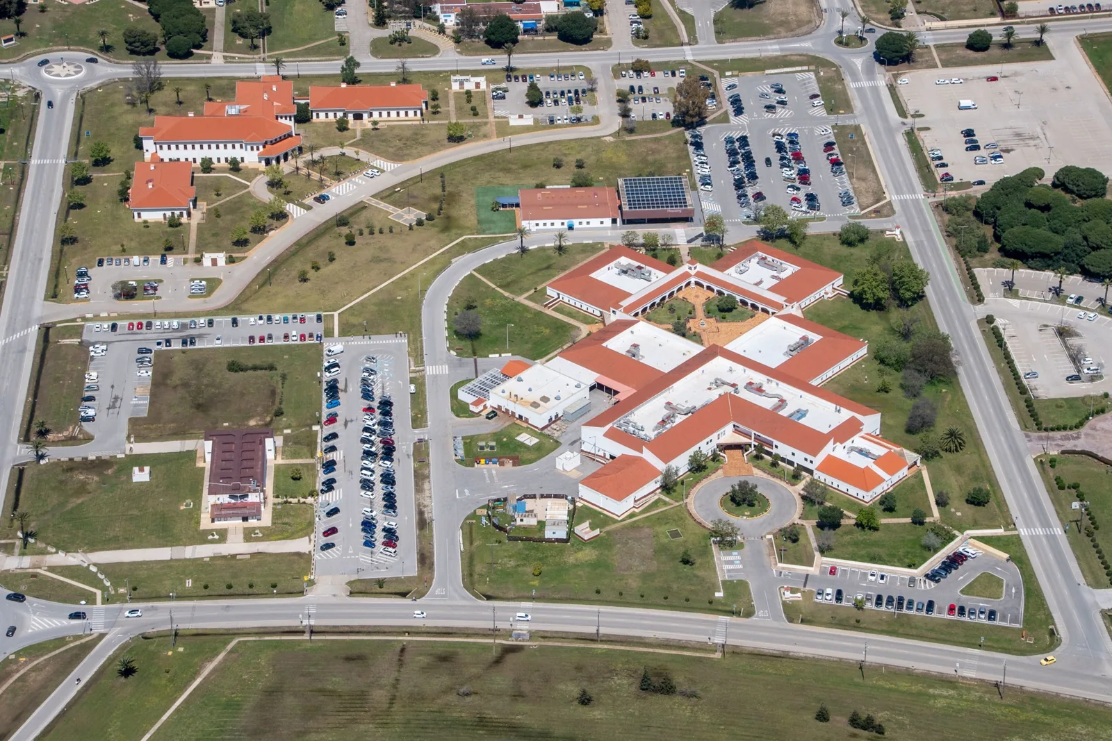
A drone inspection can give a Kent property manager a broad visual record before anyone decides where to send a crew or request a close-up test. It is useful when a roof is large, access is limited, or a high section is difficult to view from a safe walking route. We plan the flight around the building, airspace, weather, and people below, then organize the images by roof zone. Aerial photographs help show patterns, transitions, and obstructions. They do not prove that a seam is watertight or that insulation below the surface is dry. The decision still depends on what the image can show and what needs a hands-on check.
What should the image record answer?
Before flight, we define the question. The owner may need an overview of drainage, evidence of storm impact, a visual record of rooftop equipment, or a way to locate areas for follow-up inspection. A useful image set is organized by zone and includes orientation so the reader can tell where each photograph was taken. We avoid collecting hundreds of unlabelled images that leave the owner to guess which curb or roof edge is shown.
Planning also covers access, building occupants, nearby operations, and the location of people or vehicles during the flight. The pilot needs a safe launch area and clear procedures for pausing work if conditions change. Wind, rain, glare, low cloud, and light can affect image quality. If the forecast or airspace does not support safe operation, we reschedule or use another inspection method. The report records these limits instead of treating an unavailable flight as a roof finding.
Kent Valley's industrial area includes aerospace, advanced manufacturing, logistics, and global distribution businesses. A large facility may have yard traffic, rooftop exhaust, or process activity that needs coordination, but the industry label does not tell us the roof's layout. We confirm roof geometry and access with the building contact. For a property near the Kent Valley industrial base, a flight plan should avoid operational interference and capture the specific zones the owner needs reviewed.
What can aerial views show well?
Images can reveal broad membrane discoloration, debris accumulation, ponding patterns, displaced items, and roof areas that are difficult to inspect from a ladder or hatch. They can also help compare the placement of equipment, drains, skylights, and roof transitions across a large footprint. A date-stamped overview provides a reference for later visits. If the owner has prior imagery, we can align the views where conditions permit and point out visible changes without claiming a cause that the image does not establish.
Scale and perspective matter. A stain that looks extensive from above may be surface dirt, while a small raised edge may deserve a closer look. Drone imagery cannot reliably test welds, adhesion, flashing attachment, or moisture within the assembly. We label suspected conditions as candidates for field verification. If the image suggests a seam opening or drain issue, a hands-on roof inspection can examine the detail and document the result.
For leak investigation, an aerial image may help orient the crew to a suspect roof zone but cannot locate the full water path by itself. The point of entry may sit upslope from the interior stain or beneath an equipment base. We combine the image with leak history, interior observations, and field testing. When moisture below the membrane is in question, infrared moisture surveying or test cuts may provide a better answer.
How should the images be delivered?
The deliverable should support a decision rather than serve as a photo archive. We identify the property, flight date, areas viewed, weather or access limits, and image orientation. Captions point to the feature being reviewed and state whether it is a visible observation or a recommendation for further testing. If a concern is reported, we can mark its location on a roof diagram or attach a labeled image set. The owner can then connect the observation to maintenance history and scope.
Downtown Kent has a planned mix of commercial, civic, cultural, residential, and transit uses. A flight near Kent Station may need coordination around shared parking, pedestrians, or an event schedule. Those site details are confirmed before the flight rather than inferred from the neighborhood. The output can show broad roof geometry, but permissions and safe operating conditions remain a separate requirement. For a roof near Kent Station, the building contact should confirm access and the specific areas the drone needs to capture.
For an asset manager, the image set is most useful when tied to a location label and a next action. A minor observation can be placed on a monitor list. A visible opening can trigger a field inspection. Broad deterioration may justify a repair comparison or replacement review. We can add the findings to a roof condition report and preserve the visual record in the site's roof history. The record should say which conclusions depend on aerial views and which were confirmed at close range.
When should another inspection method be used?
A drone is not the right tool for every roof question. Wet insulation, hidden deck damage, seam adhesion, and a suspected leak path need testing beyond an overhead image. A roof with obstructions or restricted flight conditions may also be better inspected from approved access points. We explain what the images can answer and what remains open. The owner can then authorize a hands-on visit or moisture survey only where the evidence points to a need.
Kent's nearby Sea-Tac weather reference shows wetter conditions through fall and winter, but actual flight timing depends on the day's wind, rain, visibility, and safety conditions. We do not assume that a seasonal pattern makes a specific flight possible. If conditions prevent clear documentation, a later date can produce a more useful record. A safe, readable set of images is more valuable than a rushed pass that misses roof details.
State Route 167 passes through Downtown Kent and connects the Kent Valley with the Green River Valley. That corridor is useful context for scheduling crews and coordinating site visits, not a substitute for the property's own access plan. Whether the building is near the corridor or deeper in the industrial valley, we confirm the address, contact, and controlled areas before arriving. The report then ties the image record to the right roof and the next decision.
Commercial Roofing Questions
Can a drone inspection confirm that a roof seam is watertight?
No. Aerial imagery can show visible seam conditions, but it cannot test the weld, adhesion, or seal. We flag any apparent opening for closer inspection and use a field method appropriate to the membrane. The report distinguishes the image observation from a confirmed defect.
Can drone photographs locate a leak source?
They can help orient a roof search, especially on a broad or difficult-to-access area. Water may travel below the membrane before it appears indoors, so the source still needs to be traced with roof and interior observations. A hands-on test or moisture survey may be required to confirm the path.
What might prevent the flight from happening on schedule?
Wind, rain, poor visibility, restricted airspace, unsafe launch or landing areas, and active operations can all change the plan. We review those conditions before flying and document any area that could not be captured. If the image quality would not answer the inspection question, we schedule a safer window or use another method.
Will we receive the raw photos or an organized report?
The deliverable can include labeled images with a concise record of date, areas viewed, limits, visible concerns, and recommended next checks. The image set is organized so a manager can identify each roof zone. Where a close-up test is needed, the report says what question that next visit should answer.
Related Roofing Work
Define the roof question before the flight
Send the property address, roof access details, operating limits, and the issue you need documented. We will plan a safe flight where conditions allow and identify any finding that needs hands-on verification.